- œ ”œœ¬›≈Œ…¿ Krisztian Klajnik œ‘ 09.04.2024:
- Haines P.W. (2009). The Carribuddy Group and Worral Formation, Canning Basin, Western Australia: Stratigraphy, Sedimentology and Petroleum Potential // Geological Survey of Western Australia, Report 105, 2009
- Haines P.W. (2004). Depositional facies and regional correlations of the Ordovician Goldwyer and Nita formations. Canning basin, Western Australia with implications for petroleum exploration // Geological Survey of Western Australia, Record 2004/7
- Summary of Petroleum Prospectivity: Canning Basin (2016). Government of Western Australia, Department of Mines and Petroleum
- Glikson A.Y., Pirajno F. (2018). Asteroids Impacts, Crustal Evolution and Related Mineral Systems with Special Reference to Australia
- Geological Survey of http://www.dmp.wa.gov.au/Geological-Survey/Regional-geophysical-survey-data-1392.aspx">Western Australia.
- Interactive https://www.dmp.wa.gov.au/GeoView-WA-Interactive-1467.aspx">geological map (Western Australia):
- McLarty Hills, SE 51-15, 1:250 000 geological map sheet
- Glikson A. (2017). Structure and origin of Australian ring and dome features with reference to the search for asteroid impact events.
- Glikson A. (2018). Structure and origin of Australian ring and dome features with reference to the search for asteroid impact events // Tectonophysics. - V. 722. - P. 175-196.
10 Km diameter partially exposed circular structure with magnetic and seismic anomaly in the Canning Basin, possible age is post Ordovician (Klajnik, 2024).
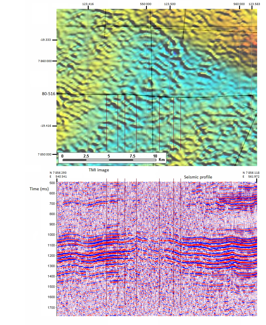
McLarty Hills structure Total Magnetic Intensity map with seismic profile
(Klajnik, 2024).
Ó¡ «Ã¡◊Œ’¿